| General Details |
|---|
| Course & Certification:
ID: 6.1.21 Description: Ocean 20/40™ Certification type: Certificate of Proficiency ISO 9001:2015 compliance course & certification. |
| Course Length:
A total of 71 hours consisting of: Pre-Course study = 4 hours; |
| Capacity of certification:
1. The GT or LOA is according to the existing CoC. 2. The references to a safe haven or from the coastline of departure of the CoC have been superseded through this Endorsement. It becomes a Oceanic Certification. 3. There can be restrictions applied for specific operations for commercial yachts engaged in charter and for commercial work-boats and their operations. These limitations will be governed by the Flag of the vessel and the insurance company. |
| Endorsement Options:
Not applicable. |
| Recognitions & approvals:
Pending, in process. |
| STCW Code:
Not applicable. |
| Certification Revalidation:
Yes required, every 5 years from date of issue. |
| Sea-time requirements:
Sea Areas Category III & IV: Sea Areas Category I & II: |
|
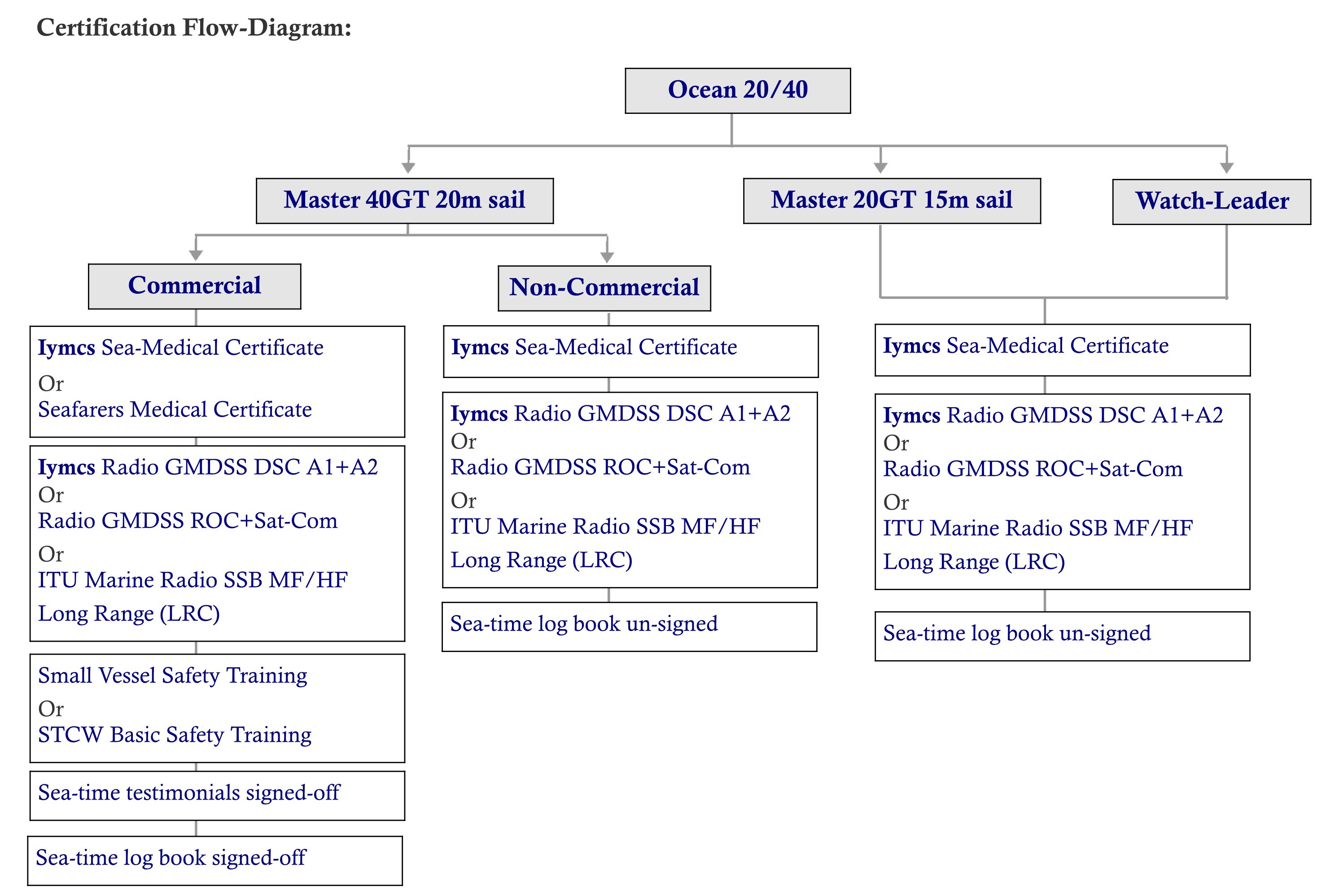
Certification issuing requirements - Non-Commercial:
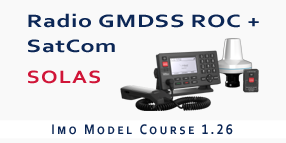
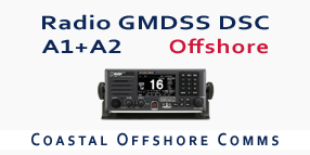
1. Iymcs Sea-Medical Certificate 2. Iymcs Radio GMDSS DSC A1+A2 Offshore 3. Sea-time Log Book unsigned Certification issuing requirements - Commercial: 4. Seafarers Medical Certificate 5. Radio GMDSS Restricted Operators Certificate + SatCom 6. Sea-time log book signed-off 7. Sea-time testimonials signed-off 8. Small Vessel Safety Trainin. |
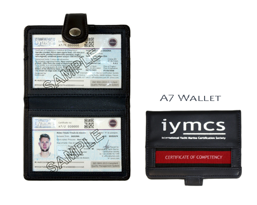
The custom-designed Iymcs wallet type certification is stylish and practical.
The wallet outer is made of real leather with a sythentic interior that is resistant to water and protects the certificates.
It is wallet size, comfortable to carry around, it is not too small to lose like the credit-card style type certifications you often see now.
The Iymcs Certificates are printed to ISO 9001:2015 standards, are dual-language and feature extensive security features to security level 3
(Government passports & national Iidentification documents are security levels 1 & 2) and can be used as a personal ID in daily situations.
(Nb. It cannot be used instead of a passport/national identity card).
The Iymcs Ocean 20/40™ is a course which appeals to the yacht owner and crew that are wanting to learn about the key aspects and up to date techniques of ocean cruising. The Course comprises of six sections; oceanic navigation theory, practical astro sights, emergency navigation techniques, heading checks, safety and general knowledge.
At the core of the Course is Celestial Navigation: For many ocean cruising sailors, learning it is regarded as a major challenge in itself. The trigonometry alone is complex, the vast array of concepts and terminologies can be difficult to grasp, the sight plotting tricky and the publications almost need a separate course to understand where, when and how to use the extracted data. For many sailors, the solution is to take a course that simplifies the subject as much as possible, this is a mistake in itself as rarely is there sufficient depth of knowledge obtained to remember how to do it after completing the course.
The Iymcs Ocean 20/40™ Course has been configured to address these issues in a unique course format that combines navigation software with traditional Celestial Navigation techniques.
The Iymcs Ocean 20/40™ Course removes the operating distances from a Safe Haven on the Iymcs Master 20GT/15m™ and Master 40GT/20m™ : It also has the capacity to do the same with Certifications issued by other organisations and Maritime Administrations.
The diagram below shows the commercial and non-commercial qualfiying aspects of this CoC when applied to other Certifications of Competency.
The Iymcs Ocean 20/40™ Course has a modern presentation to it, it builds your depth of knowledge in a logical manner and in doing so, helps you to retain your knowledge in the long-term.
Our Society, the 'International Yacht Marine Certification Society" (Iymcs) operates its entire operations under a Quality Management System
(QMS) that is in compliance with the International Standards Organisation (ISO) 9001:2015 amended. Part of this compliance involves full auditing procedures.
This is an important reference and enables us to gain recognitions from maritime admininstrations and marine industry bodies alike.
Our Society is ISO 9001:2015 certified by the British Standards Institute (BSI) Netherlands.
The QMS together with the ISO, ensures that Iymcs and its Members operate to the highest standards possible. All our courses, and more importantly the
Certifications that we issue, are under ISO 9001:2015.
This practise is most unusual for such courses and certifications. Some organisations will claim ISO:9001 adherence but often the reality is it is for a document management
process or a similar back-office process instead of for actual operations and/or for Certification issuing.
| Scandinavia 1.800,-EUR | Northern Europe 1.600,-EUR | United Kingdom 1.300,-GBP |
| Southern Europe 1.600,-EUR | Middle East 1.500,-USD | North America 1.900,-USD |
| Prices exclude: course books,certification costs,personal travelling costs,course food and course accommodation. | ||
( Vers. 1.2. ) Click-on '+' to see Syllabus.
Concept of the Celestial Sphere. Celestial heavenly bodies. Geographical Position. The Earth. The Solar System. DR & EP revision. Running Fix; near-coastal single object & two object, trigonometry errors, derived original position from parallelogram. Mathematics revision.
Subject overview & course objective. Course Sights planning The three key reference points for GP; center of the earth, the equator & the UM. Chart Projections: Mercator, Gnomonic. Great Circle, Small Circle. Great Circle Sailing principles. Composite Route Tracks. Influence of the Equator. Lower & Upper Meridians 000° & 180°.
Noon Day Sight -on-meridan, hang-period. Sailing-by-Latitude. Short-equal-Attitudes. Plot-graph sight method. Sun - off meridian Sun-run-Sun - off/off meridian. Planets - off-meridian. Moon - off-meridian. Stars. Polaris. Southern Cross. Vertical Sextant Angles. Heading checks -sun.
Position; lat & long, distance & bearing to/from object, GHA. Direction: principle of polar axis & great circle track, elevated pole, azimuth & zenith, true azimuth & zenith, Worlds Declination Model, local variation component, magnetic disturbances. Distance; Nm, Sm, angular, time. Speed; calculation of sxt=d for ocean passaging. Time: divisions of arbitrary and non-arbitrary, solar year & day, Apparent Noon, Greenwich Day, Solar Time UT/GMT, Atomic Clock Time UTC, Date Line, LMT/UT, conversion of arc to time, Zone Times/Onboard Time, Standard/Geopolitical, Meridian Passage, Equation of Time.
GP Observer. Observers Zenith. Celestial Position of the Body. GP of the Body. Declination. True Meridian Zenith Distance.
Concept diagram. Labeling of; Dec, GP body, Obs GP, Obs Zenith, ZD, LHA. Great Circle sailing.
Principles of the Sextant. Parts of the Sextant. Quality of the sextant. Examples of sextants. Adjustable errors. Fixed errors (certified). Student or candidate practice of adjustments (sextant is set out of line). Preparation for usage. Mirror, shades or scope change. Index Arm clamp spring repair. Maintenance, cleaning & storage. Artificial-Horizon Mirror.
Sextant Altitude. Index Error & Dip. Main Altitude Errors, explanation of. Corrections Table. True Altitude principal.
History of time. Harrison chronometers. The Chronometer & Deck-Watch. Atomic Clock -Worldwide stations. Time Signals ref:: ALRS. Inmarsat. Setting a time piece. The three-clock system.
Labels & terminology. Configuration menu. UTC settings. Principal menu. Primary data imput boxes. Sight/s data imput boxes. Output data result. Output Lines of Position. Data Interpretation.
Proforma types & layouts. UTC calculation. Primary data. Sight/s data. Almanac data. Sight reduction data. Intercepts LOP’s. Derived Lat. position.
Plotting Sheets: The Imray Plotting Sheet or similar. The Latitude Scale. Waypoint positioning on Gnomic projection, transfer to Mercator. Position derived from two off-meridian sights, stationary vessel. Sun-Run Sun off/off meridian. Star/Planet Sights. Assessment of the quality of the position fix; bi-sector method.
Proforma & Software Application: DR & EP reference positioning. Meridian Passage (day check). GP Declination & ‘d’ value. TMZD principle. Earth sphere diagram. Relative angular distance. Sailing time. Adding & subtracting of True alt through the earth-sphere diagram. Longitude Check, equation of time calculation. Assessment of derived position.
Earth Sphere Diagram. Position Circle; distance to/from the object, bearing to/from the object. Sight Reduction Process Overview. ‘d’ value -Table 5. Principle of Z+/-360/180 = ZN.
Proforma & Software Application: Establishing a Calculated / Chosen Position. GHA +Increments. Calculation of LHA, +E/-W. Intercept TO/AW Bearing.
Software Application: The three types of Sun-run-Sun; am + noon, noon+pm, am+pm. Exercises in am+pm (off/off). The Proformas and order of work. Order of Plot. Source of errors. Assessment of derived position.
Software Application: The four navigational planets. The Almanac. Off-Meridian. Magnitude factor. Meridian Table (Almanac). ‘V’ correction. Proforma process. Intercept.
Software Application: The relationship to the earth. Visual phasing & augmentation. Upper Limb (-30’) & Lower Limb. Horizontal Parallax sight adjustment. Almanac Moon section. Moon tables.
Software Application: 57x Navigational Stars. Principal constellations. Identification & location of. N.Hemp, S.Hemp, Equatorial Stars. Magnitude factor. 1st Point of Aries, creation of at 180°. SHA.
Software Application: Sunset, sunrise, civil, nautical and astronomical twilight. Observation period LMT/UT.
Proforma & Software Application: 1st Point of Aries. SHA. Latitude visibility. Identity & location of. True Alt + A0 + A1 + A2 -1°. True Azimuth. Observed Latitude. Heading Check.
Southern Cross Group.
Proforma & Software Application: Star Sight Reduction Tables. Plotting protocol. Assessing the position.
Proforma: Using the Sun; vessel heading. Amplitude Table 22. Amplitude Sunset or Sunrise. Reading results against a Fluxgate & Magnetic Compasses. TMC routine. Navigation Log Book entry.
Proforma: Suitable terrestrial objects. Vertical Sextant Angles using Tan Opposite of Adjacent angles.
Worlds Air Circulation Systems; the cells, the latitudes, the air circulation, the polar fronts N.hemp & S.Hemp, ITCZ Atlantic, Indian & Pacific regions, horse-latitudes, dolrums. The four Coriolis Rules. Frontal Depression -detailed explanation of elements and workings. Jet Streams; sub-tropical & polar in the Atlantic, Indian & Pacific. The four types of Fog; cause of & characteristics of each. Meteo Routing Services. Beaufort Scale. Sources of oceanic meteorological forecasts. Atlantic or Pacific synopsis charts.
Tropical Revolving Storms; Hurricane, Typhoon & Cyclone. Ocean regions and their issues. Formation in different regions. Principal characteristics. Tracking of the TRS’s. Avoiding tactics. Tropical Storms. Tropical Depressions. Tropical Disturbances. Tropical Waves.
5 Oceans of the World. The Seas of the World. The Atlantic Ridge. Parts of a wave. The formation of waves. Wave velocities. Fetch of a wave. Current circulation of the oceans. Cold & Warm currents. Ocean Gyres of currents. Influences upon the world’s tidal currents.
World Cruising Guide. Routing or Pilot Charts information. Atlantic or Pacific Routing tracks.
Charts & publications. Meteo synopsis reports. Meteo routing services. Appraisal & planning. Section headings and content. Distances DOG & DTW. Route track, legs & way-points. GMDSS. Sample passage plans.
Chart Datum Systems worldwide. Tidal Height calculation systems worldwide. Tidal Software familiarization. Interpretation of Tidal Curve. 1/4 + 1/10 Tidal Curve. Table 3 Range Table. Tidal height spot depth calculation. Bridge & cables clearance calculation. Float-off from Grounding time calculation.
Boat preparation. Rig & sail preparation. Navigation preparation. Radio equipment settings. Safety equipment & checks. Engine & generator checks. Hull & superstructure integrity. Hatches & port-lights check. Deck scupper arrangements. Crew preparation & watch-keeping arrangements. Crew personal safety equip. check. Routing around low pressure systems. Recognising type of sea & wave type. Tactics in heavy seas. Boat stability. Trailing astern for speed control; warps, sea anchors, sea drogues & parachute anchors. Landfall techniques onto difficult coastlines.
Post-navigation plotting. Plot-graph method. Short-equal altitudes. Polaris. Noon-day sight. Sailing by latitude.
Fuel tank and reserve. Water tanks & reserves. Water maker. Crew food & menu system. Bottled water reserves. Stowage organisation & plan of food provisions. Spare parts check for; rig, sail, rudder, engine & generator, steering system, propeller shaft and water maker. Repair materials for; sails, ropes, wires, GRP, and wood. Misc. sealants and glues..
Rudder and/or steering failure. Propeller shaft. Keel bolts. Dis-masting & jury-rigs. Radio antenna loss. Flooding. Grounding. Collision. Medical incidents.
Types of ownership. Yacht ownership issues. Flagging for yachts < 24 mtrs LWL. Gross Tonnage calcs for yachts. Flag Registeries & Carving/Marking Plates. Certificate of Registry. Types of ports vessel status. SOLAS & Small Vessel Codes. Duty of Care. Radio Station Licence. Internal & Territorial Waters. Health & Customs clearance. VAT & Customs Duties issues. Crewing issues (recreational crew). Chartering your own yacht. Piracy issues. Basic knowledge of Salvage. Principles of Insurance Policies. Insurance Certificates. Insurance claims procedures & issues.
Proforma & Software Application: Noon-day sun sights. AM or PM sun sights. Vertical Sextant Angle. Stars, moon & planets sights (depending on availability of the bodies). Simulated heading check or actual heading check on a vessel, using sun.